This route from the Exe Estuary to the steeply wooded valleys on Exmoor follows, for the most part, quiet country lanes and footpaths along the Exe valley through Bickleigh, Tiverton and Bampton, Exebridge, Dulverton, Hawkridge and Withypool, then leaving the Exe Valley to reach Exford to which the Exe flows from its source at Exe Head. Mostly valley scenery, ranging from the broad estuary through pastoral landscapes and narrower, heavily-wooded valleys to open moorland landscapes.
An additional described section links Withypool to the source of the Exe to make a 'source to sea' route using the Two Moors Way (TMW), north, to Simonsbath, then following the TMW waymarkers for about another 3km/2miles high up on to the moor to Exe Head. Exe Head is the source of the River Exe, an area of marshy ground high up on Dure Down.
https://www.ldwa.org.uk/ldp/members/show_path.php?path_name=Exe+Valley+Way
- Hits: 1855

Keep healthy in Exeter by using walking and cycling. Get buses to find new walks when it is safe to do so. Exeter is full of relaxing or energetic walks.
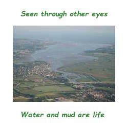
- Stroll by the River Exe and the Exeter Ship Canal
- Train for a marathon by walking or running the Exeter Cosy Routes
- Visit the green lungs of Exeter by walking Exeter's Green Circle
- Look for wildlife on the River Exe Wild Walk
- Go farther by cycling the Exe Estuary Trail or walking the Exe Valley Way and the Devonshire Heartland Way
Use this site to plan your walks, look at the Covid19 data on the Devon Dashboard, listen to the science and exercise your personal responsibility as well as our body and mind.
- Hits: 3086
Unlike the more traditional pilgrimage routes which focus on destination or a specific pathway, the Sacred Waters Way offers you a series of individual pilgrimages which guide you through the seasons. Each pilgrimage gives opportunities to pause and reflect on your own inner journey and your connectedness to the earth and her living waters.
https://www.devonpilgrim.org.uk/route/sacred-waters-way-2/
Social Media:
Facebook: https://www.facebook.com/PilgrimageDevon/ (168)
Twitter: https://twitter.com/PilgrimageDevon (151)
Instagram: https://www.instagram.com/pilgrimagedevon/ (74)
- Hits: 1169
Follow in the footsteps of pilgrims past and present on the Archangel’s Way across the north of Dartmoor, from towering St Michael’s church atop Brentor to St Michael the Archangel’s in Chagford, a bustling market town. Throughout the route there are indications of how man has connected with the unique landscape to live as an interconnected part of it, from the Neolithic stone circles and ancient wells to more recent industrial past. The Archangel’s Way invites you to breathe deep, become more conscious of your spirit and spend some time to re-connect.
https://www.devonpilgrim.org.uk/route/archangels-way/
Social Media:
Facebook: https://www.facebook.com/PilgrimageDevon/ (168)
Twitter: https://twitter.com/PilgrimageDevon (151)
Instagram: https://www.instagram.com/pilgrimagedevon/ (74)
- Hits: 1326
A 40 mile walking route through outstanding East Devon
East Devon Way is the perfect way to discover the hidden gems of the East Devon Area of Outstanding Natural Beauty
Follow our well waymarked 40 mile walking route using our guidebook or downloadable walk directions to find the best viewpoints, picnic spots and learn about the flora, fauna and local history. The route runs from the seaside twon of Exmouth to Lyme Regis, passes through eight villages and crosses five rivers.
https://www.eastdevonway.org.uk/
- Hits: 1158
Route eight – Darts Farm via Topsham to Countess Wear Bridge. With return via University sports field and Newcourt Road 7 miles. Thanks to route sponsor Rodney Spiller Wealth Management.
Darts Farm is a family business that began as a pick your own farm shop 50 years ago. Topsham dates from Celtic times, becoming the port of Exeter under the Romans. There are many Dutch style houses from its days as an important cotton port. It became part of the city of Exeter in 1966. The route crosses the Clyst and follows the River Exe east bank to Countess Wear, with good opportunities for bird watching, returning on inland roads and footpaths.
NB: CHECK TIDE TIMES FOR TOPSHAM, AS THE RIVERSIDE PATH IS UNDER WATER AT HIGH TIDE, WHEN THE ALTERNATIVE ROAD OPTION SHOULD BE FOLLOWED
https://exetercosyroutes.files.wordpress.com/2021/05/exeter-cosy-route-eight.pdf
https://connect.garmin.com/modern/course/57362767
Social Media:
Facebook: https://www.facebook.com/exetercosyroutes
- Hits: 1482
Read more: Exeter COSY Route 8 - Darts Farm to Countess Wear Bridge
Route seven – Clyst St Mary via Clyst St George to Darts Farm. With return via Ebford 7.3 miles. Thanks to route sponsor Wilkinson Grant & Co.
Clyst St Mary was the site of a brutal battle in the 1549 Prayer Book Rebellion. But this is a peaceful route taking footpaths through the housing development Winslade Park, quiet roads to Clyst St George, and on to Darts Farm. Circular return on footpath to Ebford, quiet road looping east of Clyst St George, back to Kenniford Cross and returning on same footpaths to Clyst St Mary.
https://exetercosyroutes.files.wordpress.com/2021/05/exeter-cosy-route-seven.pdf
https://connect.garmin.com/modern/course/57363902
Social Media:
Facebook: https://www.facebook.com/exetercosyroutes
- Hits: 1524
Read more: Exeter COSY Route 7 - Clyst St Mary to Darts Farm
Route six – Blackhorse via Sowton to Clyst St Mary. With return via Bishop’s Court 4.5 miles. Thanks to our route sponsors, the Baker Family.
This route is entirely within East Devon District Council area, the villages of Clyst Honiton, Sowton and Clyst St Mary being Exeter’s closest eastern neighbours. Clyst is a Celtic word meaning clear water and the villages take their name from the River Clyst, a tributary of the Exe. This is a mainly level route along footpaths and quiet lanes to Clyst St Mary. The circular return includes a busier road without pavements and two short, but steep climbs.
NB: Fields on this route are in an area of flood plain, and may be muddy and wet after rainfall, inaccessible in times of heavy rain. There is a difficult stile over the bridge at Clyst St Mary, but an easier alternative is available.
https://exetercosyroutes.files.wordpress.com/2021/05/exeter-cosy-route-six.pdf
https://connect.garmin.com/modern/course/57364003
Social Media:
Facebook: https://www.facebook.com/exetercosyroutes
- Hits: 1450
Read more: Exeter COSY Route 6 - Blackhorse to Clyst St Mary
Route five – Pinhoe via Pinn Lane, Gipsy Hill and Redhayes Bridge to Blackhorse. With return via Mosshayne Farm 4.5 miles. Thanks to route sponsor Cumberland Grange care home.
Pinhoe is a former village that in 1966 became a suburb of Exeter. It was called Pinnoch in the Domesday book. In recent years it’s seen a huge growth in housing development. There are small shops and refreshment outlets. The route heads over the Waterloo rail line towards the motorway and Redhayes pedestrian and cycle bridge. The circular return is along quiet lanes until the main road back to Pinhoe, which is busy but fully pavemented.
https://exetercosyroutes.files.wordpress.com/2021/05/exeter-cosy-route-five.pdf
https://connect.garmin.com/modern/course/57364337
Social Media:
Facebook: https://www.facebook.com/exetercosyroutes
- Hits: 1370
Route four – Pennsylvania Road via Stoke Hill and Beacon Hill to Pinhoe. With return via Beacon Heath and Mincinglake Valley Park 6.5 miles. Thanks to route sponsor Green Tree Court care home.
The start of this walk passes just below the highest point in Exeter at the top of Stoke Hill, once the site of a Roman signal station. From this elevation, the route descends through quiet footpaths, fields, tracks, and stretches on roads without pavements. There are scenic views at Beacon Hill by St Michaels and All Angels Church, a descent to Harrington Lane. You can return to the start via Mincinglake Valley Park.
https://exetercosyroutes.files.wordpress.com/2021/05/exeter-cosy-route-four.pdf
https://connect.garmin.com/modern/course/57364490
Social Media:
Facebook: https://www.facebook.com/exetercosyroutes
- Hits: 1630
Read more: Exeter COSY Route 4 - Pennsylvania Road to Pinhoe