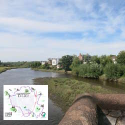
Route three – Level crossing via Argyll Road to Pennsylvania Road. With return via Duryard Valley Park 3.8 miles. Thanks to route sponsor Southern Healthcare.
The first mile of this route is of busy road and rail. Red Cow level crossing is on the main Exeter to Paddington railway line, and also the Tarka line for North Devon. A steep uphill climb, with a return descent through woodland trails and splendid views.
https://exetercosyroutes.files.wordpress.com/2021/05/exeter-cosy-route-three.pdf
https://connect.garmin.com/modern/course/57364867
Social Media:
Facebook: https://www.facebook.com/exetercosyroutes
- Hits: 1356
Read more: Exeter COSY Route 3 - Exwick to Pennsylvania Road
Route two – Marsh Barton via Twisted Oak, Barley Lane and Exwick to Red Cow level crossing. With return via riverside path 7 miles. Thanks to route sponsor Stonehaven Care Group.
Alphington is a former village, now south western suburb of Exeter, among former notable residents were the parents of Charles Dickens. The route mostly follows quiet lanes or pavemented roads on the edge of St Thomas, Redhills and Exwick, all suburbs of the city. It climbs initially and has wonderful views from Barley Lane across the city. A notable feature is the Twisted Oak, a huge oak with a twisted corkscrew like trunk. The origins of it being twisted are unknown, but it’s said that at one time passers-by would raise their hats to it. After descending on paths through Exwick to the Red Cow level crossing, you can return to the start on an easy flat walk alongside the river and canal.
https://exetercosyroutes.files.wordpress.com/2021/05/exeter-cosy-route-two.pdf
https://connect.garmin.com/modern/course/57365027
Social Media:
Facebook: https://www.facebook.com/exetercosyroutes
- Hits: 1464
Route one – Countess Wear Bridge via Exminster to Marsh Barton. With return along canal bank 6.4 miles. Thanks to route sponsor Haines Watts, Chartered Accountants.
There are a series of bridges near Countess Wear, the original red sandstone bridge was built in 1774, swing and bascule bridges were built in later centuries to span Exeter Canal, which, dating from the 1560s, is one of the country’s oldest canals. The route follows the towpath and footpaths to Exminster, a village dating from the 8th century. There’s a steep climb to high above the motorway, descent to the Devon Motel and into Matford Business Park and Marsh Barton, which has Europe’s largest number of car showrooms. This route finishes at the bridge over the Alphinbrook on Hemyock Road. You can return to Countess Wear Bridge by following the path along the canal.
https://exetercosyroutes.files.wordpress.com/2021/05/exeter-cosy-route-one.pdf
https://connect.garmin.com/modern/course/57365328
Social Media:
Facebook: https://www.facebook.com/exetercosyroutes
- Hits: 1406
Read more: Exeter COSY Route 1 - Countess Wear Bridge to Marsh Barton
Eight circular routes around the city, making one full 26.2 mile marathon distance.
The Exeter COSY Route project is a community wellbeing and dementia awareness initiative created for Exeter Dementia Action Alliance to signpost people of all abilities to routes on the edge of the city where they can walk and run.
From its roots in an ancient Greek battle to mass participation events around the world, the marathon length of 26.2-miles is a distance that capture’s the imagination. Perfect for Exeter’s unique COSY route – COSY being an acronym for circle of somewhere yours as that’s what it is.
The full circle will take you to every compass and hill viewpoint around Exeter, following footpaths, quiet lanes, field tracks, over stiles, through woodland, paved roads, some busier parts of the city, along its suburban fringe and into neighbouring village communities.
You’ll cross the river and canal, go under and over the M5 motorway, step over both the Exeter to London rail lines, and pass churches, pubs, schools, and local businesses.
Whether you take on this challenge over months, weeks, days or in one strenuous go, you’ll see the city as never before, and complete a marathon in doing so.
https://exetercosyroutes.wordpress.com/
Social Media:
Facebook: https://www.facebook.com/exetercosyroutes
- Hits: 1719

Did you know? You can still see the remains of some significant quarries in east Exeter. For some houses, the quarry face is their garden wall!
Heavitree Breccia is our local stone. It starts here and reaches out. Many of Exeter’s most interesting and historic buildings are built of it. It has a character all of its own. It’s a deep, Devonian red but is particularly characterised by being very coarse in texture. And it’s ours!
https://heavitreequarrytrails.org.uk/
- Hits: 1971

The Exeter Green Circle is a twelve mile walk that provides a great walking experience within the boundaries of Exeter - from green countryside valley parks to the pavements of quiet leafy suburbs.
The walk is made up of five sections:
- The Alphin Brook Walk (3 miles)
- The Ludwell Valley Walk (3 miles)
- The Mincinglake Walk (2 miles)
- The Hoopern Valley Walk (2 miles)
- The Redhills Walk (2.5 miles)
https://exeter.gov.uk/leisure-and-culture/walking-in-exeter/exeter-green-circle-walks/
Social Media:
Facebook: https://www.facebook.com/exetergreencircle (973)
- Hits: 2344
Exeter Trails are a collection of 5 hand drawn maps, depicting over 100 of the fantastic independent shops and cafes that the city has to offer. Launched in 2013 after the success of the ‘Christmas Shopping Trail’ initiative, Exeter Trails hopes to highlight and support Exeter’s wonderful independent shopping scene. The maps were illustrated by local artist Phillip Harris, and can be picked up, for free, all across the city.
Original founders of the project were Mattie Richardson from Bunyip Beads & Buttons, Sue & John Taylor from Cafe at 36, Nathan and Hayley Maker from No Guts No Glory, Les Bright from The Real Food Store and Penny Nicholson from Penny’s Recipes, with Lily Otton from Otton’s Haberdashery and Cassie Leicester from Good Golly Miss Molly joining the team in 2014. All those involved work on a volunteer basis, own or are involved with independent retailers, and have a really strong passion for championing small business.
Social Media:
Facebook: https://www.facebook.com/exetertrails (1.5k)
Twitter: https://twitter.com/exetertrails (2.3k last post 2016)
Instagram: https://instagram.com/exetertrails/ (500 last post 2015)
- Hits: 947

The Torbay Totnes Trail runs from Torquay Railway Station to Totnes Castle. The route between Cockington Country Park and Totnes is shared with the John Musgrave Heritage Trail.
Torquay Station to Marldon Church 4 miles, 6.4 km
Marldon Church to Berry Pomeroy Castle 2 miles, 3.2 km
Berry Pomeroy Castle to Totnes Castle 3.8 miles, 6.1 km
Rail Walks This route showcases the best inland scenery South Devon has to offer, on quiet way-marked footpaths and country lanes. You’ll see the picture postcard thatched cottages of Cockington, with an option to explore the Cockington Country park. You’ll pass Berry Pomeroy castle, supposedly one of the most haunted in the UK. And in between, South Devon’s rolling fields, woods and streams.
http://railwalks.co.uk/totnestorbaytrailov/
- Hits: 3509

In Devon, we love good quality, locally produced food and drink, and here in Exeter there is no shortage of it, from bees producing honey on the rooftops of Princesshay shopping centre, to local wines being produced in vineyards on the sheltered slopes surrounding the city. There are plenty of opportunities to sample fresh, Devon produce in many of Exeter's cafes and restaurants, or shop directly with the producers at the weekly Farmers Market.
Exeter's location in the heart of Devon, surrounded by fertile farmland and close to miles and miles of coastline makes it easy to shrink your food footprint here. The city's outlying farms proudly show off their wares in farm shops, such as those at Quickes, Greendale and Darts Farm, as well as hosting special talks and demonstrations.
The Exeter Food & Drink Trail will celebrate these fantastic local producers, bringing them together on a map showcasing Exeter's food and drink offering.
https://www.visitexeter.com/food-and-drink/exeter-food-and-drink-trail
https://www.visitexeter.com/dbimgs/Food%20&%20Drink%20Trail%20MAP%20July%201%202020.pdf
- Hits: 1629
The Templer Way is a route for walkers linking Haytor on Dartmoor with the seaport of Teignmouth. It has a length of 18 miles/29km and covers a wide range of scenery from open moorland, woodland, meadow, historical tracks and urban land, through to estuary foreshore.
Using a mixture of rights of way, permissive routes and minor roads, the Templer Way takes about 10 hours to walk. Tide times should be checked before setting out.
The route may be tackled in short stretches or in one go and is waymarked in both directions, except on the open moorland at Haytor Down, where the granite rails of the tramway can be followed.
https://www.exploredevon.info/activities/walk/long-walks/templer-way/
- Hits: 1574