Buckerell
Buckerell is a small village and civil parish in the East Devon district of Devon, England. The village is about 2.5 miles west of the nearest town, Honiton. In the 2001 census a population of 270 was recorded for the parish, which is surrounded clockwise from the north by the parishes of Awliscombe, Honiton, Gittisham, Feniton and Payhembury.
The Church of St Mary and St Giles dates from the 13th or 14th century and has been designates as a Grade II* listed building. There is a richly-carved Chancel screen. There is a statue of Britannia by John Bacon, in memory of Admiral Samuel Graves and his wife.
https://en.wikipedia.org/wiki/Buckerell
Buckerell Parish Council
https://buckerellparishcouncil.co.uk/
Lockdown Necessities
Weather
https://www.metoffice.gov.uk/weather/forecast/gcj9n9dff (Awliscombe)
IMPACT Community Carbon Calculator
Welcome to the Impact tool for community carbon footprinting. This tool was developed by the Centre for Sustainable Energy (CSE), as part of their Climate Emergency Support Programme, working jointly with the University of Exeter’s Centre for Energy & the Environment (CEE), as part of their South West Environment and Climate Action Network (SWeCAN) project.
The aim of the tool is to give small communities data on their carbon emissions that is easy to interpret, easy to share, and which gives them a clear idea of their main ‘impact areas’ – those big segments where concerted, community based action could really make a dent in local emissions. The information is displayed visually via a series of charts.
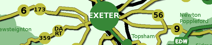
OpenStreetMap
OpenStreetMap is built by a community of mappers that contribute and maintain data about roads, trails, cafés, railway stations, and much more, all over the world.
https://www.openstreetmap.org/search?query=buckerell#map=14/50.7972/-3.2462
BusTimes.org
the unofficial home of bus, coach and ferry transport information. This interactive map shows bus stops and live bus positions with links to routes and time tables.
https://bustimes.org/map#14/50.7972/-3.2462
Devon County Council Environment Viewer
Information on Devon's environment has been mapped on our Environment Viewer. These maps give access to spatial (geographic) data for Devon on a wide range of topics.
DEFRA MAGIC Map
The MAGIC website provides geographic information about the natural environment from across government. The information covers rural, urban, coastal and marine environments across Great Britain. It is presented in an interactive map which can be explored using various mapping tools that are included. Users do not require specialist software and can access maps using a standard web browser.
Genuki
GENUKI provides a virtual reference library of genealogical information of particular relevance to the UK and Ireland. It is a non-commercial service, maintained by a charitable trust and a group of volunteers.
https://www.genuki.org.uk/big/eng/DEV/Buckerell
Tithe Map
The tithe maps and apportionments are an important source of information about the history and topography of a parish. They provide details of land ownership and occupation, and the type of cultivation of the land, and are often the earliest complete maps of parishes.
https://www.devon.gov.uk/historicenvironment/tithe-map/buckerell/


