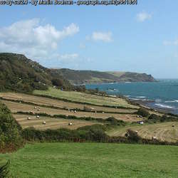
A Devon Wildlife Trust Nature Reserve
Devon Wildlife Trust's latest nature reserve. A must for bird watchers. No access at present to the nature reserve but great views of it and its wildlife are available from a public road/path…
https://www.devonwildlifetrust.org/nature-reserves/horsey-island
- Hits: 1219

North Devon Coast AONB Braunton's Great Field truly lives up to its name. It is treasured as one of only two surviving medieval open strip field systems in England and is believed to date way back the 1200s. Here you can walk through a medieval landscape; covering an area of around 350 acres (equivalent to 200 football pitches). Such fields were the norm in medieval England but virtually all have since been lost or modified.
History This huge field would have been used by hundreds of landworkers, busily farming the food they needed to support their families. The land was farmed in narrow strips, most comprising of 22 yards (one chain) by one furlong (220 yards) in length, which interestingly makes an acre, which it was said was the amount an Oxen could plough in a day. Clusters of strips were given field names such as Gallowell, Pitlands, Longhedgelands, etc.
In 1840 it was recorded that the Great Field was divided into some 600 strips in 60 different ownerships. Today the land is worked by just a small number of farmers but clues to the field's ancient heritage are easy to spot. Although some of the distinct landsherds (small mounds of earth separating the strips) have been lost through modern farming methods together with the Bond Stones which marked division in ownership, many landsherds and the furlough boundary tracks still remain in place.
https://www.northdevon-aonb.org.uk/explore/braunton-great-field
- Hits: 1586
The North Devon Coast Areas of Outstanding Natural Beauty (AONB) covers 171 square kilometres (66 square miles) of mainly coastal landscape including special places such as Combe Martin, Lee Bay, Woolacombe, Croyde, Saunton, Northam Burrows Country Park, Westward Ho!’s Pebble Ridge, the Hartland Peninsula and Braunton Burrows, a UNESCO World Biosphere Reserve.
http://www.northdevon-aonb.org.uk/
Social Media:
Facebook: https://www.facebook.com/explorethecoast/ (5.6k)
Twitter: https://twitter.com/explorethecoast (5.6k)
- Hits: 1186

Wikipedia The Little Dart River is a tributary of the River Taw in Devon, England. It joins the Taw a mile west of Chulmleigh.
The Little Dart rises near Rackenford. It flows west past Witheridge and through a deep wooded valley between Chawleigh and Chulmleigh before meeting the Taw.
https://en.wikipedia.org/wiki/Little_Dart_River
River Levels:
https://riverlevels.uk/little-dart-chawleigh-chulmleigh
- Hits: 1734
Westcountry Rivers Trust The River Taw rises high on the slopes of Dartmoor and together with its tributaries, the River Mole, Yeo and little Dart, runs north through beautiful rolling countryside down to Barnstaple and into the Bristol Channel.
At 45 miles long, the Taw is one of the larger Devon rivers. The Taw provides habitat for a wide range of animals and plants alike, resulting in many stretches of the river being protected as Sites of Special Scientific Interest (SSSI). The Taw estuary which forms part of the UNESCO Biosphere reserve is a fantastic place to spend the day watching the many different types of wading birds that can be found there. The number of wading birds, including lapwings, curlews and redshanks, can reach over 20 000!
https://wrt.org.uk/project/river-taw/
- Hits: 1385
The East Devon Area of Outstanding Natural Beauty (AONB) is a unique landscape, full of contrast and colour, diverse and rich in wildlife – a landscape, shaped by centuries of farming, with a natural beauty that’s so precious it’s protected in the nation’s interest.
https://www.eastdevonaonb.org.uk/
Social Media:
Facebook: https://www.facebook.com/eastdevonaonb1963 (118)
Twitter: https://twitter.com/EastDevonAONB (2.5k)
Issuu: https://issuu.com/eastdevonaonb
- Hits: 1401
Exmoor was designated as a National Park in 1954. Since then, the co-ordination of work to achieve National Park purposes in the area has been undertaken by local government and since 1997 by a free standing Exmoor National Park Authority.
Exmoor National Park Authority decides what measures to take to achieve the two National Park purposes;
"To conserve and enhance the natural beauty, wildlife and cultural heritage of the National Park"
"To promote opportunities for the understanding and enjoyment of the special qualities of the National Park by the public"
In carrying out these purposes the Authority has a duty to seek to foster the economic and social well-being of local communities within the national parks
All planning applications within the National Park area are determined by the National Park Authority and applications are dealt with at our offices in Dulverton. Planning policies are there to ensure both rural prosperity and the protection and enhancement of the special character of Exmoor.
https://www.exmoor-nationalpark.gov.uk/
Social Media:
Facebook: https://www.facebook.com/ExmoorNP (13.7k)
Twitter: https://twitter.com/exmoornp (12.1k)
Pinterest: https://www.pinterest.com/ExmoorNP (136)
YouTube: https://www.youtube.com/channel/UCgUgh9Nu0z80VPO961Z-9tQ (306)
Instagram: https://instagram.com/exmoor_national_park/ (4.4k)
Flickr: https://www.flickr.com/photos/exmoornp/albums (46)
- Hits: 1249

Dartmoor National Park Authority was created by the Environment Act 1995 to:
- conserve and enhance Dartmoor National Park’s natural beauty, wildlife and cultural heritage
- promote opportunities for the public to understand and enjoy the special qualities of Dartmoor National Park.
Social Media:
Facebook: https://www.facebook.com/enjoydartmoor1 (16.3k)
Twitter: https://twitter.com/dartmoornpa (18.4k)
Instagram: https://www.instagram.com/lovedartmoor/ (14.7k)
YouTube: https://www.youtube.com/user/DartmoorNPA (1.7k)
Dartmoor Food and Drink Map
https://www.dartmoor.gov.uk/living-and-working/local-food-and-drink-map
- Hits: 1380
A Devon Wildlife Trust Nature Reserve
Woodland walks give way to stunning estuary views on the edge of Plymouth.
https://www.devonwildlifetrust.org/nature-reserves/warleigh-point
- Hits: 1271
This landscape of elevated coastal plateau rises gently towards the coast affording distinctive views inland across and down the Salcombe to Kingsbridge Estuary and as far as Dartmoor. It drops abruptly into the sea with dramatic cliffs forming a spectacular rugged coastline; and between Prawle Point and Start Point raised beaches (some of which are farmed) are a defining feature revealing the effects of past coastal erosion during time of higher sea levels. Above the cliffs areas of colourful bracken, gorse and blackthorn often occur, providing important habitat for birds including cirl bunting. Although it appears relatively uniform in height, the plateau is incised by coastal combes containing small streams and the upper reaches of tributaries to the Salcombe to Kingsbridge Estuary. Along the coast this landscape has an ‘edge of the world’ feel, offering exhilarating walks and a strong sense of tranquillity and isolation.
This area comprises an elevated coastal plateau and rugged coastline running east-west from Bolt Tail to Start Point and flanks the southern reaches of the Salcombe to Kingsbridge Estuary. To the south, east and west the landscape is fringed by the sea and to the north the boundary of this area is marked by a transition to a slightly lower lying inland plateau landscape which is less influenced by the coast.
https://www.devon.gov.uk/planning/south-hams-area/bolt-tail-and-start-point-coastal-plateau
https://www.devon.gov.uk/planning/planning-policies/landscape/devon-character-areas
- Hits: 1209