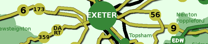
A settled and farmed lowland landscape, which gives the impression of being a fertile and prosperous agricultural area. The patchwork of fields and hedgerows is characterised by red soils, a wide variety of crops and numerous orchards, giving the area a rich variety of colours and textures, particularly in spring and late summer. The tree-fringed rivers Yeo, Creedy, Culm and Exe snake in meandering courses across their wide floodplains, past historic mills, bridges and weirs, all of which contribute to the time-depth of the landscape. The numerous prehistoric barrows hint at earlier phases of the landscape’s evolution. Crediton, with its historic town centre and splendid red stone parish church gives its surroundings a more developed character.
This relatively flat area contains land to the east and west of Crediton, and is dominated by several river valleys. It includes parts of the valleys of the Yeo (and its tributary the Creedy) in the west and the Culm in the east as well as the productive farmland between them centred on the Exe. To the north are transitions into the steeper landforms of the Exe Valley, Cullompton Rolling Farmland and the Crediton Rolling Farmland. To the west is a gradual transition into the more elevated landscapes of the High Taw Farmland. To the east (beyond the Culm valley) are the Clyst Lowland Farmlands and to the south are the more wooded landscapes of the Yeo Uplands and Slopes and the Exeter Slopes and Hills.
https://www.devon.gov.uk/planning/east-devon-area/mid-devon-area/yeo-culm-and-exe-lowlands
https://www.devon.gov.uk/planning/planning-policies/landscape/devon-character-areas
- Hits: 1013
The colourful patchwork of fields, thick hedgerows and distinctive red soils visible in this area combine to form a quintessential ‘Devon’ scene. The area is the ‘gateway’ into Devon when viewed from the major transport corridors (road and rail) which pass through it. Its sense of history as a transport corridor is apparent in the Grand Western Canal, which flows serenely through the area, crossed by distinctive bridges. Despite the presence of busy transport routes and several large settlements, the valley of the River Culm retains a peaceful atmosphere, with the tree-lined river meandering through a wide floodplain.
This area is located to the east of Tiverton, and includes land to the east and west of the M5. To the west is an abrupt descent into the Exe Valley, while to the east the land rises sharply where it meets the Blackdown Hills. To the north is a gradual transition into the Bampton and Beer Downs and to the south (beyond the River Culm) lie the Clyst Lowland Farmlands.
https://www.devon.gov.uk/planning/east-devon-area/mid-devon-area/culm-valley-lowlands
https://www.devon.gov.uk/planning/planning-policies/landscape/devon-character-areas
- Hits: 988
The River Exe meanders through a deep and dramatic wooded valley lined with lush oak woodlands displaying changing seasonal colours. Its side valleys are particularly quiet and secretive, with a very strong sense of enclosure. The historic town of Tiverton sits on the banks of the river, its red sandstone churches, castle, bridges, school and impressive early19th century textile mill dominant in the scene. South of Tiverton, the Exe valley landscape opens out into a patchwork of fields, woodlands and copses with a much gentler character.
This area runs north-south and contains the middle reaches of the River Exe, extending westward to include the lower parts of two of its tributaries. To the west is the higher land of the Cruwys Morchard Wooded and Farmed Valleys; and to the east the higher land of the Bampton and Beer Downs and the Cullompton Rolling Farmland. To the south is a more gradual transition from the wider Exe Valley floor into the Yeo, Culm and Exe Lowlands. To the north is the county boundary with Somerset, although the character of the Exe Valley continues beyond it.
https://www.devon.gov.uk/planning/east-devon-area/mid-devon-area/exe-valley
https://www.devon.gov.uk/planning/planning-policies/landscape/devon-character-areas
- Hits: 1150
A ‘typical’ Devon landscape characterised by a harmonious patchwork of fields, thick hedges, red soil, deep lanes and attractive villages. This productive, settled agricultural landscape contrasts with the looming mass of Dartmoor, which forms the southern horizon in many views, particularly from the south of the area. Views are often restricted by hedgebanks, but where they occur they are often panoramic. The landscape is diverse, with irregular, often rounded hills dissected by small but well-marked valleys, lending a small scale and intimate appearance to the landscape. The long east-west ridge of the Raddon Hills forms a distinctive landmark, particularly in views from the southern part of the Exe valley.
This area comprises the rolling agricultural land to the north west of Crediton. To the north and north-east respectively are gradual transitions to the Witheridge and Rackenford Moors and the Cruwys Morchard Wooded and Farmed Valleys. To the south is a gradual transition to the lower land of the Yeo, Culm and Exe Lowlands. The High Taw Farmland lies beyond the River Yeo to the west.
https://www.devon.gov.uk/planning/east-devon-area/mid-devon-area/crediton-rolling-farmland
https://www.devon.gov.uk/planning/planning-policies/landscape/devon-character-areas
- Hits: 1139
Situated between the valleys of the Exe and the Culm, this is an area of quiet, peaceful countryside, largely undisturbed by the roads and settlements on its periphery. Its steeply undulating hills and serene valleys have seen relatively few modern changes. Sunken lanes and tracks, a colourful patchwork of hedged fields, and numerous historic farmsteads remain a part of the fabric of today’s landscape, giving the area a strong sense of changelessness and time-depth, despite its proximity to Exeter. The red soils and sandstone buildings give the area a colourful and warm quality which is enhanced by the deciduous trees in hedgerows and alongside streams.
This area runs north-south and contains the middle reaches of the River Exe, extending westward to include the lower parts of two of its tributaries. To the west is the higher land of the Cruwys Morchard Wooded and Farmed Valleys; and to the east the higher land of the Bampton and Beer Downs and the Cullompton Rolling Farmland. To the south is a more gradual transition from the wider Exe Valley floor into the Yeo, Culm and Exe Lowlands. To the north is the county boundary with Somerset, although the character of the Exe Valley continues beyond it.
https://www.devon.gov.uk/planning/east-devon-area/mid-devon-area/cullompton-rolling-farmland
https://www.devon.gov.uk/planning/planning-policies/landscape/devon-character-areas
- Hits: 1103
This is a remote and quiet landscape with few through-routes, and is rarely visited by non-locals, giving it a remote, peaceful, timeless quality. Steep lanes run between high hedgebanks rich with colourful flowers. The flat hilltops have a sense of airy spaciousness, with long views towards the Blackdowns to the south and east, and an almost aerial aspect over the lush, deep green woodlands of the Exe valley to the west. In contrast to the open hilltops, the valleys feel enclosed and secretive. In the south, the historic parkland of Knightshayes Court adds seasonal colour and exotic species to this pastoral Devon landscape.
This character area is located to the north-east of Tiverton, and consists of a series of flat-topped hills interspersed with valleys. To the north is a gradual transition to the higher land of the Exmoor Fringe. To the east is the Somerset border, although the character of the landscape continues beyond it. To the south is a clear fall in height to the Culm Valley Lowlands, and to the west an abrupt drop into the Exe Valley.
https://www.devon.gov.uk/planning/east-devon-area/mid-devon-area/bampton-and-beer-downs
https://www.devon.gov.uk/planning/planning-policies/landscape/devon-character-areas
- Hits: 1123
This is an area of spectacular seascapes, with a rugged, jagged coastline containing a series of rocky headlands and small coves with grey shingle beaches. The western part of the area has a remote and ancient feel, with extensive areas of colourful coastal heath and grassland containing prehistoric standing stones. The area around Ilfracombe is more developed, its imposing Victorian architecture telling the story of its rise as holiday destination. The enclosed, wooded coastal combes (each with its own unique character) cut through rolling, agricultural downland to the sea. Trees are prominent features which soften the windswept landscape of the open downland below the ridge tops.
This area comprises the north-facing coastline around Ilfracombe. To the east is the boundary with Exmoor National Park (outside the remit of this study) and to the south is a gradual transition into the North Devon Downs. To the south-west is the North Devon Coastal Downs. The boundary between the North Devon High Coast and the North Devon Coastal Downs is marked by the change in the aspect and orientation of the coastline.
https://www.devon.gov.uk/planning/north-devon-area/north-devon-high-coast
https://www.devon.gov.uk/planning/planning-policies/landscape/devon-character-areas
- Hits: 1009
This is a simple, agricultural landscape dominated by the sky within an open, westerly aspect. The smooth hills have rounded profiles, and are covered by a patchwork of large, regular fields. Views are long and wide, sometimes with glimpses of the sea or estuary as a backdrop. The steep valleys which punctuate the downland run like wooded ribbons across the landscape, contrasting with the farmland in their rich colours and textures. These valleys have a secluded and secretive character. They are very tranquil, the only sounds often being birds and running water; and their sunken lanes have a timeless quality.
This area is located to the north of Barnstaple and comprises high open farmland interspersed with secluded wooded valleys. To the north is the North Devon High Coast with its coastal combes; to the east a gradual transition to the wooded, intricate landscapes of the Exmoor Fringe; to the south a gradual transition to the Codden Hill and Wooded Estates and also a more abrupt transition (marked by the change in topography) with the Taw-Torridge Estuary. To the west is a gradual transition (with increasing coastal influence) to the North Devon Coastal Downs.
https://www.devon.gov.uk/planning/north-devon-area/north-devon-downs
https://www.devon.gov.uk/planning/planning-policies/landscape/devon-character-areas
- Hits: 1192
This landscape of rolling, interlocking ridges, deeply incised by river valleys and patterned by beech hedges, provides an important setting and transition to Exmoor. The upland river valleys drain southwards from the high moorland, forming deep clefts in the landscape that contain clean, fast-flowing water and are clothed in ancient oak woodlands. The Bray valley is the major landscape feature of the western part of the area; further east the valleys are shorter, steeper and narrower. Tree features and hilltop clumps form notable landmarks. The area is sparsely settled, with individual farmsteads and small hamlets and vernacular buildings that are mainly of sandstone and slate. Seen from the south, the area forms the foreground landscape to Exmoor. Seen from the north it forms a diverse and strongly patterned patchwork of fields and wooded valleys.
This area abuts the southern and western boundaries of Exmoor National Park (not part of the Devon Landscape Character Assessment). Bounded to the west by the more open landscape of the North Devon Downs and to the south by the South Molton Farmlands and Witheridge and Rackenford Moor, this area of enclosed pastoral land with deep north-south wooded valleys rises northwards to the Exmoor moorland rim, where there is a clear landscape transition.
https://www.devon.gov.uk/planning/north-devon-area/exmoor-fringe
https://www.devon.gov.uk/planning/planning-policies/landscape/devon-character-areas
- Hits: 1092
An open, elevated landscape, where the long views out make an important contribution to the sense of place. The high land of Exmoor (to the north) and Dartmoor (to the south) provide orientation, and a backdrop of seasonally-changing colour. In the north, views out to sea and across the north Devon coast lend a strong maritime influence. Views across and into the neighbouring Taw and Torridge valleys emphasise the contrast between this open farmland and the wooded, enclosed and intimate valley landscapes on either side. Skylines are very important, with clumps of trees and square church towers acting as prominent features and landscape focal points. Woodland and occasional patches of unimproved grassland contribute to the seasonally-changing colour and texture of the landscape.
This long, narrow area comprises the ridges of high land between the Taw Valley (to the east) and the Torridge Valley (to the west). To the north is the lower-lying Taw-Torridge Estuary, and to the south is a gradual transition to the open inland plateau of the High Taw Farmland.
https://www.devon.gov.uk/planning/torridge-area/high-culm-ridges
https://www.devon.gov.uk/planning/planning-policies/landscape/devon-character-areas
- Hits: 2008